Choi-wan may strengthen as Hong Kong stays hot
HK01 · 4 SOURCESabout 2 hours ago2 MIN
Summary
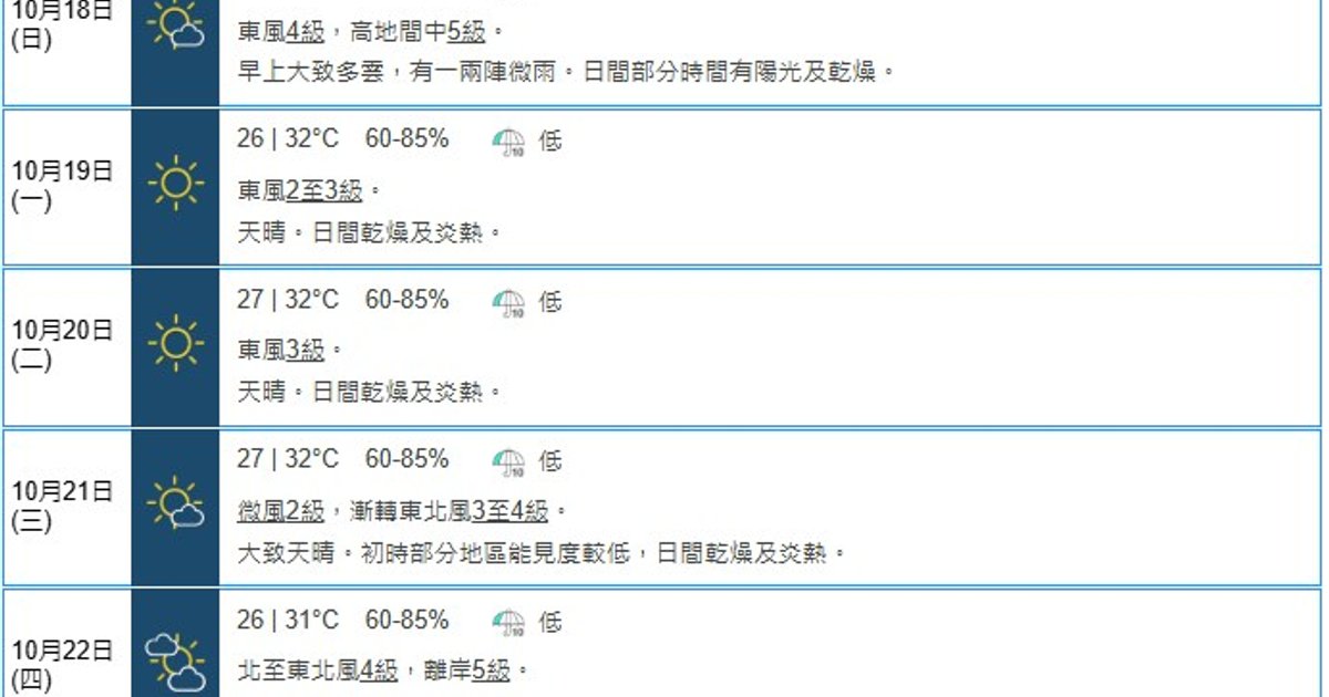
Tropical cyclone Choi-wan formed over the northwestern Pacific on October 15 and is expected to strengthen as it passes near Guam before moving toward waters east of Luzon early to mid next week. The Hong Kong Observatory said the storm’s later path remains uncertain, but it currently has a higher chance of turning north and crossing waters east of Taiwan. For Hong Kong, an easterly airstream is bringing stronger winds and a few showers around October 17 and the Chung Yeung Festival on October 18, before weather turns generally fine, dry and hot from October 19 to 21. Mainland forecasters at the Central Meteorological Observatory said Choi-wan could intensify by four categories within four days and reach super typhoon strength from October 18
Key Points
- The Hong Kong Observatory said Choi-wan would gradually intensify over the next one to three days while crossing the Guam area.
- Early to mid next week, the cyclone is forecast to move toward waters east of Luzon, with later movement still subject to uncertainty.
- The Observatory said the storm has a greater chance of recurving northward and passing across waters east of Taiwan rather than heading directly west.
- The Central Meteorological Observatory forecast Choi-wan to strengthen by four categories in four days and become a super typhoon from October 18
- In Hong Kong, Chung Yeung Festival on October 18 is forecast to start cloudy with one or two light rain patches, then become sunnier and drier.
Why It Matters
For Hong Kong readers planning grave-sweeping and holiday travel over the Chung Yeung long weekend, the immediate concern is less a direct storm threat than changeable winds, isolated light rain and then very hot daytime conditions. The cyclone’s later track remains uncertain, so attention is likely to stay on whether it curves away east of Taiwan or evolves into a closer regional weather factor.