Typhoon White Dolphin Tracks West With Uncertain Path
Crhk · 2 SOURCESabout 11 hours ago2 MIN
Summary
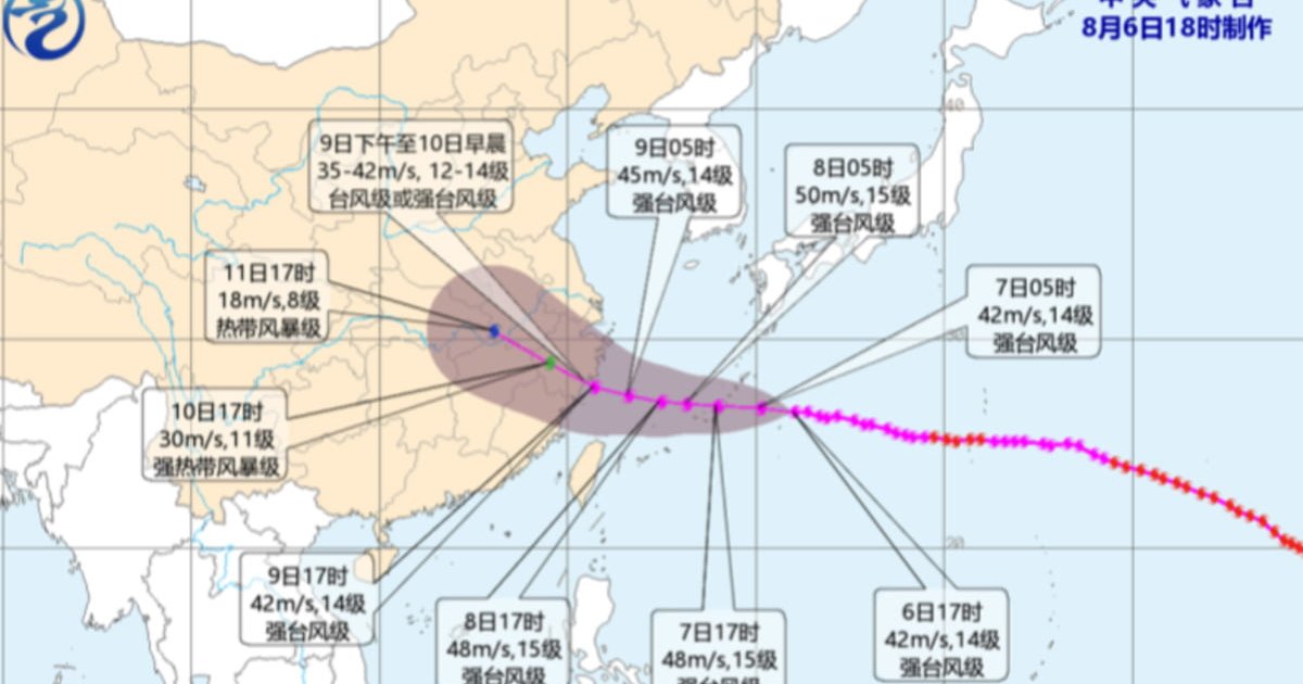
Severe Typhoon White Dolphin is continuing on a generally westward track and edging closer to eastern China, but forecasters say the storm’s later movement remains subject to significant uncertainty . It is expected to cross the Ryukyu Islands around Friday, enter the East China Sea, then slow down as it approaches the East China coast . Current projections suggest possible landfall from the Yangtze estuary to northern Fujian between Sunday afternoon and early Monday, though a northward turn toward the Yangtze estuary or even the Shandong Peninsula coast remains possible . Hong Kong is not in the direct path, but the storm’s outer subsiding air is expected to bring very hot weather and trigger thunderstorms later in the period .
Key Points
- China’s central observatory issued a yellow typhoon alert as White Dolphin moved west at about 15 to 20 kilometres per hour .
- Forecasts say the storm will pass through the Ryukyu Islands, enter the East China Sea, then slow while nearing eastern China .
- One scenario brings landfall from the Yangtze estuary to northern Fujian around Sunday to early Monday at typhoon strength .
- Another scenario has White Dolphin turning north, affecting the East China Sea, Yellow Sea, Shanghai, Jiangsu, Anhui and Shandong .
- Hong Kong expects extreme weekend heat, with some New Territories districts reaching 36 degrees or above under subsiding air .
Why It Matters
The storm’s uncertain track means emergency planning must cover a wide stretch of coastline, from Zhejiang and Fujian to the Yangtze estuary and possibly farther north . Its rainbands and wind field could affect multiple densely populated provinces, while Hong Kong may avoid a direct hit but still face dangerous heat and locally triggered thunderstorms .