Police Drone with Thermal Imaging Rescues Lost Hiker on Pat Sin Range in Under One Hour
HK01 · 3 SOURCES1 day ago3 MIN
Summary
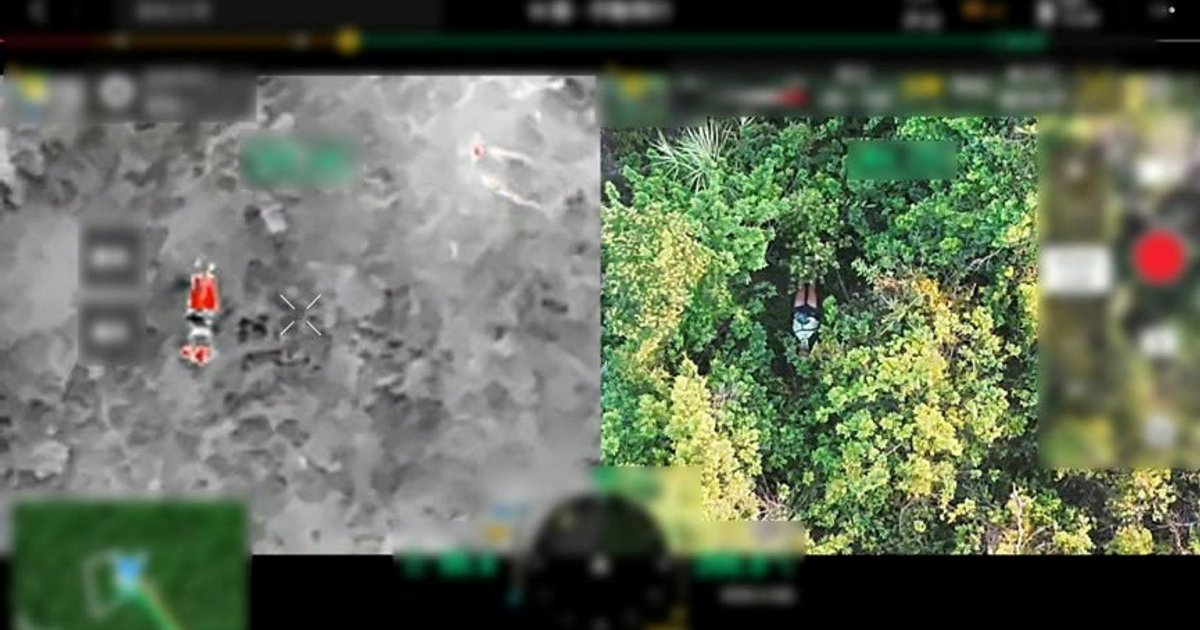
A 41-year-old foreign national was rescued from the Pat Sin Range Country Park in Tai Po on October 24 after becoming lost while hiking alone. The incident occurred when the man, who had set out from Lung Mei Village that morning, lost his way near Pine Ridge along Wilson Trail Section 9 en route to Beacon Hill. Unable to continue due to exhaustion, he called for help through the 999 emergency line at 4:51 pm. Police and the Fire Services Department jointly launched a search operation, deploying a drone equipped with thermal imaging technology. Within 30 minutes, the drone detected the hiker's heat signature, and ground rescue teams were guided to his location approximately 40 metres from the trail. The Government Flying Service subsequently airlifted the man to safety after initial medical treatment.
Key Points
- The incident occurred on October 24 at Pat Sin Range Country Park in Tai Po, where a 41-year-old foreign hiker became lost near Pine Ridge on Wilson Trail Section 9
- Police received the emergency call at 4:51 pm through the 999 Emergency Operations Centre, with the man reporting exhaustion and inability to continue his journey
- A joint rescue operation involving Police and Fire Services Department used a drone with thermal imaging, which detected the hiker's location within 30 minutes of deployment
- The drone also used its broadcast function to communicate with the man, confirming he was conscious before ground teams arrived at his location about 40 metres off the trail
- Police Officer Cheung Kwan-wa (Cheung Kwan-wa) from Tai Po District Rural Patrol Unit noted that the drone's thermal imaging significantly boosted search efficiency, completing the entire rescue within one hour
- The rescued man later visited Tai Po Police Station to personally thank all rescue personnel and praised the high efficiency of Hong Kong's emergency services
- Police reminded the public to avoid hiking alone, travel with companions, and download the HKSOS mobile application, which can automatically transmit location data during emergencies
Why It Matters
The successful rescue demonstrates how drone technology with thermal imaging is transforming mountain search and rescue operations in Hong Kong, reducing what could be a multi-hour search to just 30 minutes. Police have indicated plans to continue integrating various technologies into frontline operations to enhance public safety capabilities. This incident also underscores the importance of the HKSOS application and responsible hiking practices, as authorities prepare for increased outdoor activity during the cooler autumn months.
The successful rescue demonstrates how drone technology with thermal imaging is transforming mountain search and rescue operations in Hong Kong, reducing what could be a multi-hour search to just 30 minutes. Police have indicated plans to continue integrating various technologies into frontline operations to enhance public safety capabilities. This incident also underscores the importance of the HKSOS application and responsible hiking practices, as authorities prepare for increased outdoor activity during the cooler autumn months.