Hong Kong Faces Week of Showers and Thunderstorms Amid Lingering Heat
HK01 · 1 SOURCESabout 2 hours ago2 MIN
Summary
A southwestern airstream is bringing cloudier conditions and scattered showers to Hong Kong today (August 13), providing temporary relief from the extreme heat that saw the Observatory's Tsim Sha Tsui headquarters record 35.1 degrees on August 11. The weather will remain unstable through the week, with thunderstorms expected to affect the region intermittently. Next week, a broad low-pressure trough may approach the coast, potentially triggering more intense weather conditions.
Key Points
- Hong Kong recorded 35.1 degrees at the Observatory's Tsim Sha Tsui headquarters on August 11, marking an extreme heat event
- A southwestern airstream is affecting the Guangdong coast, with cloud cover increasing and localized showers developing
- Daytime temperatures will range from 32 to 34 degrees in urban areas, with New Territories temperatures 1-2 degrees higher
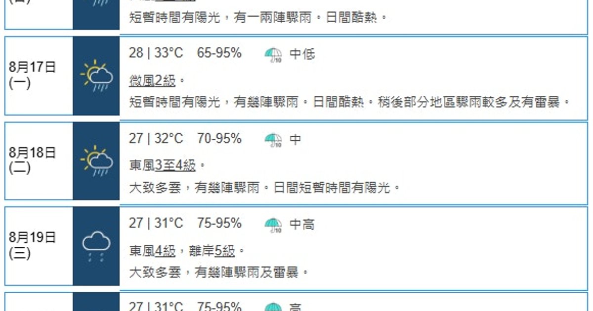
- Tomorrow (August 14) will see intermittent heavy showers and thunderstorms, with temperatures between 27-32 degrees
- The Qixi Festival on August 19 will bring several rounds of showers and thunderstorms, with severe weather on August 20
- AI forecast systems including AIFS, Pangu, and Fengwu predict low-pressure area formation next week but unlikely to develop into tropical cyclone
Why It Matters
The combination of lingering heat and frequent thunderstorms poses health risks for outdoor workers and commuters, particularly during peak hours. The potential low-pressure system next week could disrupt the Qixi Festival celebrations and affect transportation across the Pearl River Delta region.
The combination of lingering heat and frequent thunderstorms poses health risks for outdoor workers and commuters, particularly during peak hours. The potential low-pressure system next week could disrupt the Qixi Festival celebrations and affect transportation across the Pearl River Delta region.